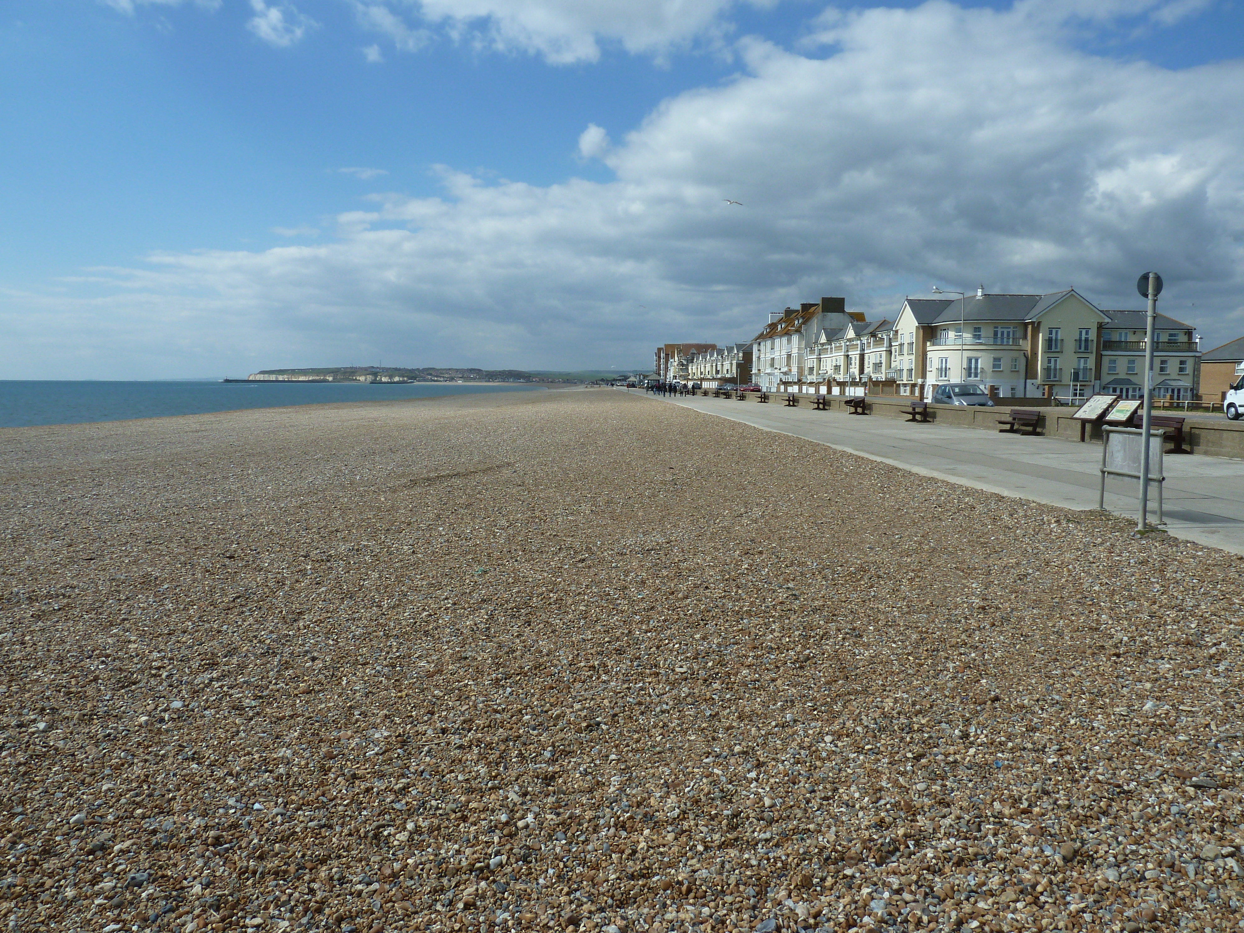
Seaford Beach: A Practical Guide to the Shingle, the Swimming and the Beach Huts
Seaford's long shingle beach is a man-made flood defence, rebuilt in 1987 with gravel dredged off the Isle of Wight and shaped to a deliberately steep slope. This practical guide explains why the water gets deep so quickly, how to swim safely, how to hire a beach hut, where to park, eat and find toilets, the summer dog rules, and what to look out for between the Buckle and Splash Point.
Seaford's beach is the town's front garden: a long, clean sweep of shingle running from the chalk of Seaford Head west towards Newhaven. First-time visitors are often surprised by how quickly it drops into deep water. Here is what you need to know.
Why the beach shelves so steeply
The shingle you walk on is largely man-made. Through the 20th century Seaford's natural beach was steadily lost to shingle extraction, to Newhaven's harbour arms cutting off the supply of pebbles from the west, and to storms. Gravel from Dungeness in 1936 and 1958 did not stop the decline, and by the 1950s storm waves were regularly breaking against the sea wall and flooding the road.
The answer was one of the biggest beach recharge schemes of its day. Carried out in 1986 and 1987, it placed around 1.5 million cubic metres of gravel (the SCOPAC sediment study gives 1,670,000m³) along 2.5km of frontage, using shingle dredged off the Isle of Wight. The new beach was built to a crest 25 metres wide, 6.5 metres above Ordnance Datum, and with a deliberately steep 1 in 7 seaward slope. A large terminal groyne was built at Splash Point to stop the shingle drifting east. That engineered profile is why the water gets deep within a few strides of the shoreline.
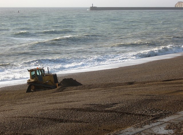
The beach is still a working flood defence. The Environment Agency describes 4km of shingle between east Newhaven and Seaford Head which, with a buried sea wall, protects 459 properties. Waves push the pebbles towards both ends, so twice a year (autumn and late winter) lorries and bulldozers move up to 60,000 cubic metres back to the middle. Keep clear of the machinery.
Swimming safely
Seaford is a designated bathing water and was rated Excellent by the Environment Agency in 2025. Before you get in:
- It gets deep fast. The official Seaford Beach Guide warns that "the beach shelves steeply, meaning the water gets deep quickly". Stay in your depth; climbing out up steep pebbles is harder than getting in. Beach shoes help, and guard against weever fish.
- Currents run along the shore. It is easy to drift unnoticed, and an orange windsock means offshore wind: no inflatables.
- The swimming zone. Yellow buoys mark a 200m bathing zone between Splash Point and Edinburgh Road, where boats must keep below 8 knots. The water-ski lane is at Splash Point.
- Do not jump off groynes, and keep away from the foot and edge of the chalk cliffs at Splash Point.
- Lifeguards. There is no RNLI cover. Seaford Lifeguards, a volunteer club founded in 1970, patrol at weekends in the summer holidays (currently 11am to 5pm). In an emergency dial 999 and ask for the Coastguard.
Beach huts
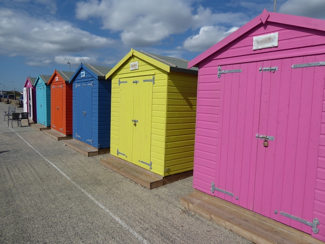
Seaford Town Council runs three groups of huts along the Esplanade:
- West View. A row of brightly painted council huts near Frankie's Beach Café at the western end of the seafront, available for daily hire through the summer (up to 14 days per person or family). Two, Starfish Shack and Northern Sole, are fully accessible. They are for daytime use only (8am to 9pm), with keys collected from Frankie's. Check the council's beach huts page for this season's prices and booking link.
- Martello. Near the tower, a mix of privately owned huts on licensed plots and 10 council huts leased to Seaford residents. The waiting list is currently closed because of demand.
- Bonningstedt Promenade. Built by the council and now all privately owned.
Parking, toilets and refreshments
On-street parking along the Esplanade and Marine Parade is free (check signs for time limits); on hot weekends it fills by mid-morning. Motorhomes are limited to 12 hours on the Esplanade. Lewes District Council's Buckle car park on Marine Parade (BN25 2QR) has a 2m height barrier. EV chargers are in the town-centre car parks (Sutton Road, Saxon Lane, West Street), and Seaford station is a short walk from the front.
Public toilets are at the Martello Tower (refurbished in 2024), at The Buckle car park, and inside the Salts recreation ground just back from the front. For food and drink, try Frankie's Beach Café at West View, Holy Cow! Beach Shack on the Esplanade, Lola's & Bonpa's at the Martello, or Bayo at the Salts.
Dogs
From 1 May to 30 September, dogs are banned from the beach between Edinburgh Road and West View, and must be kept on a lead on the promenade alongside it. Elsewhere, and in winter, dogs are welcome; the quieter ends towards the Buckle and Seaford Head are best for a run.
From the Buckle to Splash Point
At the western end, the Buckle takes its name from the Buckle Inn, shown on an 1823 map and demolished in the early 1960s (Seaford Museum gives 1962). Beyond it the shingle runs towards the ruins of Tide Mills (opens in a new tab) and Newhaven's breakwater, usually the emptiest part of the bay.
In the middle, the Martello Tower (built 1806 to 1810, now Seaford Museum (opens in a new tab)) marks the busiest stretch.
At the eastern end, Splash Point is where the town stops and the cliffs begin. In spring and summer it is the best place to watch the kittiwake colony (opens in a new tab), and on rough days the waves live up to the name. Walk up from here onto Seaford Head (opens in a new tab) for the classic view of the Seven Sisters.
Sources
- Seaford Town Council: Seaford Seafront (opens in a new tab)
- Seaford Town Council: Seaford Beach and Inshore Waters Guide (2025) (opens in a new tab)
- Seaford Town Council: Beach huts (opens in a new tab)
- Seaford Town Council: West View beach huts available for daily hire (opens in a new tab)
- Seaford Town Council: Public toilets (opens in a new tab)
- Environment Agency: Shingle all the way at Seaford beach this winter (2022) (opens in a new tab)
- Environment Agency: Shingle moved to improve flood protection in East Sussex (2023) (opens in a new tab)
- Environment Agency: Seaford bathing water profile (opens in a new tab)
- University of Sussex CoastView: Seaford Beach and Seaford Head (opens in a new tab)
- University of Sussex CoastView: Seaford (opens in a new tab)
- SCOPAC Sediment Transport Study: Seaford beach literature review (opens in a new tab)
- Seaford Lifeguards (opens in a new tab)
- Seaford Museum: The Buckle Inn (opens in a new tab)
- Hero image: Seaford beach and Esplanade, by Dave Spicer, Geograph via Wikimedia Commons, CC BY-SA 2.0 (opens in a new tab)