How Seaford Lost Its Sea: The 1539 Diversion of the Ouse
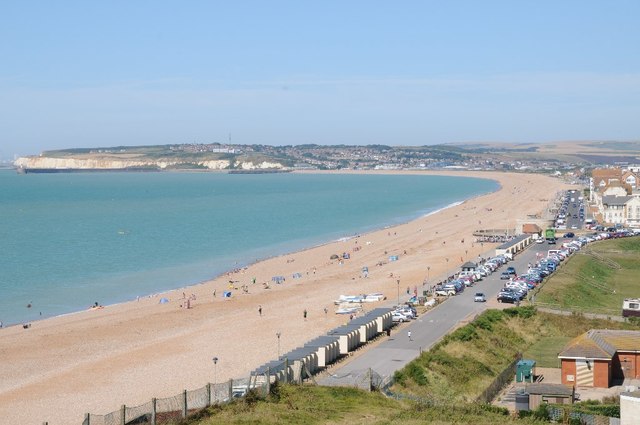
For centuries the River Ouse reached the sea under Seaford Head, and the harbour it made turned a Sussex village into a Cinque Port with two Members of Parliament. Then, in 1539, commissioners of sewers cut a new outlet through the shingle three miles west at Meeching. The village was renamed New Haven. Seaford was left with a beach. The strangest part of the story is that nobody was trying to take the town's harbour away: the cut was a farmers' land-drainage scheme, paid for by a tax on flooded fields twenty miles inland.
A Harbour That Was Always Moving
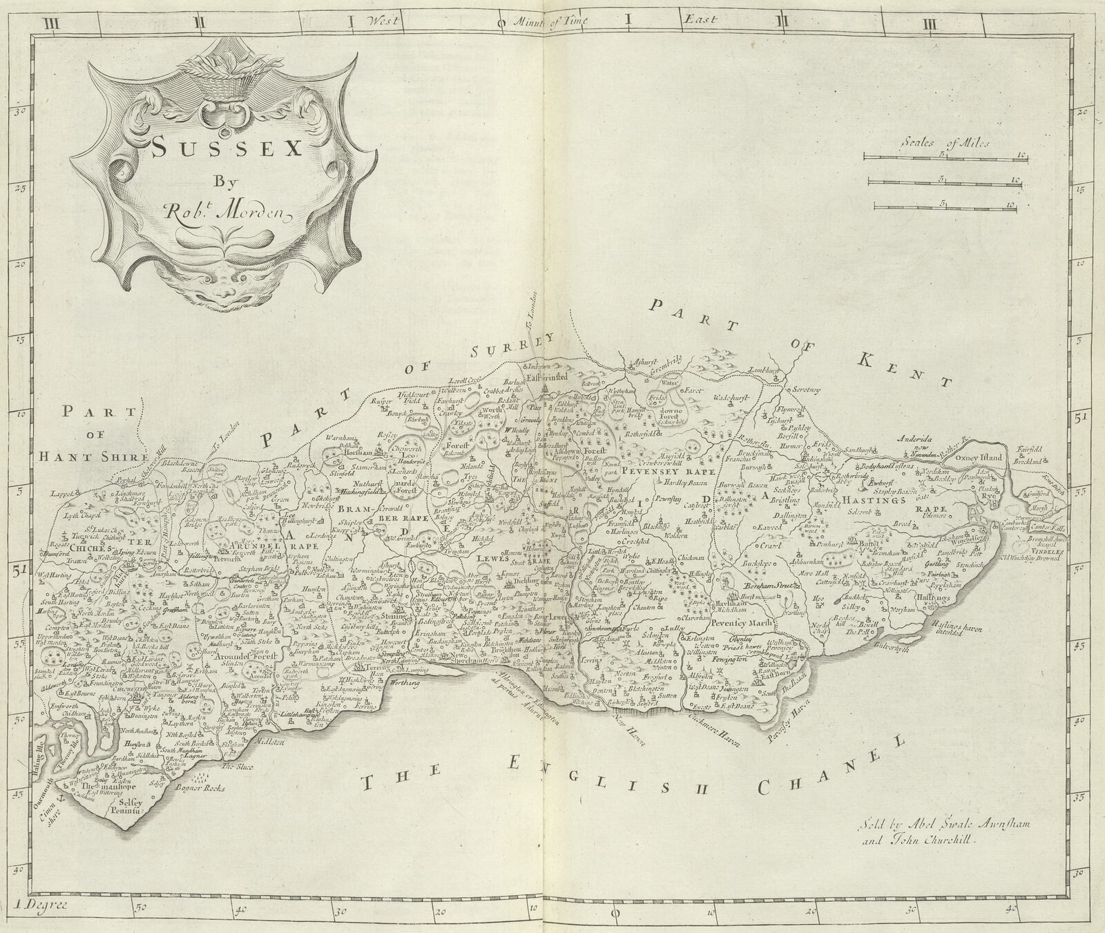
In Roman times the River Ouse met the sea at the western edge of its valley, beneath the chalk shoulder now called Castle Hill at Newhaven. It did not stay there. Waves arriving from the south west drove shingle steadily eastward along the Sussex coast, and the growing bank pushed the river mouth ahead of it. By the early Middle Ages the Ouse was running roughly two miles east, penned behind a shingle spit, and breaking out into the sea under Seaford Head near what we now call Splash Point.
That accident of geology made Seaford. An eighth-century document describes the place as *Super fluvium Saforda*, "on the river Saforda". By 1229 Seaford was recorded as the chief limb of Hastings in the Cinque Ports confederation. In 1298 it won the right to send two Members to Parliament, a privilege no other limb port ever achieved. In 1342 it sent three ships to Edward III's French wars, and by 1347 its official levy stood at five ships and 80 marines.
The Slow Silting
The same drift that built the harbour eventually strangled it. Through the 14th and 15th centuries the spit kept extending eastward, narrowing and shallowing the channel. Landowners upstream made things worse: the reclamation of tidal saltmarsh, known locally as inning, cut the volume of water moving in and out on each tide, and with less scour the silt simply stayed put. Add repeated French raids and the plague that drove the townspeople to petition Richard II for tax relief in 1380, and Seaford entered the Tudor period as a port in terminal decline.
A Drainage Problem, Not a Harbour Problem
Here is the part of the story that usually gets left out. The decision that finished Seaford was not taken by sailors, merchants or the Crown. It was taken by farmers.
A blocked river mouth does not only stop ships. It stops water leaving. Behind the shingle lay the Lewes and Laughton Levels, some 6,000 acres of low ground stretching up the valley. After the great flood of autumn 1421, Henry V appointed a Commission of Sewers in the spring of 1422, charged with the banks and drainage between Seaford and Fletching, around twenty miles inland. By the early 16th century most of the Levels lay permanently under water, grazing land reverted to fen, and one stretch was known simply as the Brodewater.
In 1537 the commissioners levied a scot, a water rate, on every landholding in the Levels to pay for a fix, reportedly taking advice from Dutch drainage engineers. The plan was not to build a harbour. It was to let the water out.
The Cut of 1539
The commissioners cut a new outlet roughly a mile long through the shingle beneath Castle Hill, at the fishing hamlet of Meeching. The work was finished probably by 1539. It did exactly what it was meant to do: the Levels drained, and the Brodewater went back to being a meadow.
It also ended Seaford's harbour at a stroke. With the river taking the shorter, steeper western route, there was no longer any flow behind the bar to keep the old channel open. The sheltered water under Seaford Head silted and closed. Meeching now sat beside a working river mouth, and from the mid 16th century took a new name from it: the new haven.
The New Haven Was No Bargain Either
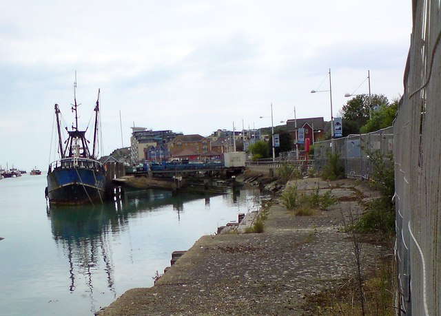
Seaford's loss did not translate into an easy win for its neighbour. The 1539 cut had no piers, and the shingle that had buried one river mouth promptly began burying the next. It was swept shut repeatedly and dug out again at the expense of the commissioners and local merchants. The Armada survey of 1587 already shows the mouth deflected several hundred metres east of Castle Hill. A pier built around 1670 under royal letters patent swallowed an estimated £5,000 and collapsed in the 1680s. By the Admiralty chart of 1698 the entrance had closed altogether and the river was escaping a kilometre to the east, near Tide Mills.
It took an Act of Parliament in 1731 and an engineer, John Reynolds, to make it stick. A new entrance opened in October 1733 and the piers were finished in 1735, then rebuilt in 1791 to 1793 at a cost of around £17,000. The decisive work came much later: a modest trap groyne built west of the west pier in 1843 to 1845, of which a contemporary wrote, "This simple and inexpensive work created the port of Newhaven." The long Western Breakwater followed in 1889. Newhaven needed 350 years and a great deal of money to hold the mouth that Seaford lost in one season.
What Seaford Became Instead
The collapse was fast and brutal. By 1596 Seaford had 38 householders, among them seven fishermen sharing a single boat. The town could no longer afford to send its Members to Parliament, and when the franchise was restored in 1641 it became a pocket borough managed by the Pelham family through sinecures and patronage. Seaford spent the next two centuries as a small, poor, salt-blown town with a sideline in smuggling, its boats hauled up the shingle rather than moored at a quay.
What rescued it was not the sea but the railway, which reached Seaford in 1864 and reinvented the place as a bathing resort. Look for the old harbour today and you will find it under your feet: The Salts, the flat green behind the beach where Seaford Cricket Club plays below sea level, is the floor of the vanished haven.
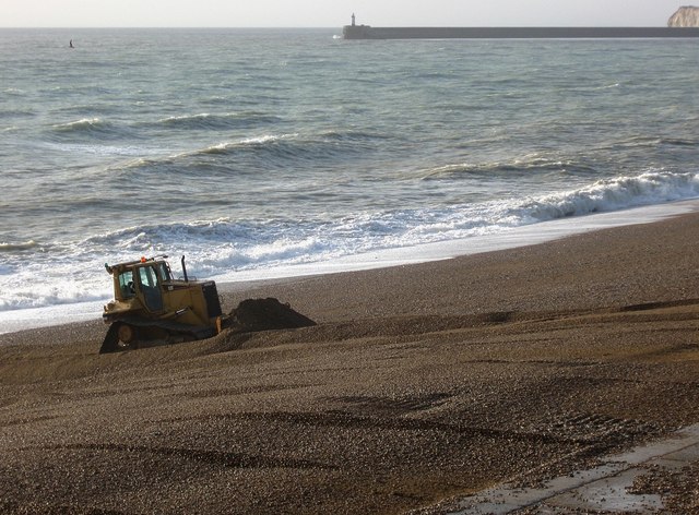
And the shingle has never stopped. The current sea defences date from the early 1980s and depend on regularly recharging the beach, topped off in 1987 by the £620,000 terminal groyne at Splash Point. A bulldozer still tracks along Seaford beach, pushing the stones back where the town wants them. The argument Seaford lost in 1539 is, in a sense, still being had.
Sources
- Seaford Museum and Heritage Society, "History of Seaford": seafordmuseum.co.uk
- University of Sussex CoastView project, "Mouth of the Ouse": sussex.ac.uk
- John H. Farrant, *The Harbours of Sussex 1700-1914*, "The Port of Newhaven" (1976): PDF via University of Sussex
- P. F. Brandon, "The Origin of Newhaven and the Lewes and Laughton Levels", *Sussex Archaeological Collections* 109 (1971), pp. 94 to 106
- Wikipedia, "Lewes and Laughton Levels": en.wikipedia.org
- Wikipedia, "Newhaven, East Sussex": en.wikipedia.org
- Discover Seaford project archives, recovered pages from seaford.co.uk and seaford-sussex.co.uk