The Ouse Estuary: The River That Made and Unmade Seaford
For centuries the River Ouse was Seaford's lifeline, feeding a tidal lagoon that made the town a Cinque Port. In 1539 the river walked away, leaving a marsh and a beach. Today's Ouse Estuary Nature Reserve, the Cuckmere meanders restoration and the local Renaturing Seaford project are slowly inviting the water back.
A Town Built on a Tidal Lagoon
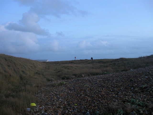
Long before the streets of Seaford appeared on any map, the River Ouse curved south-east along the foot of the chalk Downs and emptied into a broad, sheltered lagoon behind a great shingle bar in Seaford Bay. That bar, the same shingle that today carries the promenade from the Buckle to Splash Point, was thrown up over thousands of years by the tides and the prevailing south-westerly winds. As it grew, the river behind it was forced to thread its way along the back of the bank, breaking out sometimes near Buckle, sometimes at Splash Point, and forming the natural harbour that gave the town its name. An eighth-century document refers to the place as *"Super fluvium Saforda"*, "on the river Saforda."
That harbour, and the boats that worked it, made Seaford. By 1229 the town was a Cinque Port. In 1298 it was granted the right to send two Members to Parliament. The river was the reason.
The Day the River Walked Away
In 1539 the river walked away. After a sequence of storms, and possibly with deliberate human help from the merchants of nearby Meeching, the Ouse abandoned its old course and broke through the shingle bar three miles to the west. The new mouth was deeper, less prone to silting, and far more useful for the larger sailing ships of the Tudor age. Meeching was promptly renamed *New Haven*, and Seaford was left with a marsh where its harbour used to be and a beach where its quayside had stood.
For the next four centuries the lower Ouse was treated, by and large, as an inconvenience to be drained. The wetlands behind the shingle were embanked, ditched and pulled into use as grazing brookland. By the late 20th century, what had once been a tidal estuary teeming with fish and wildfowl was a low, intensively farmed plain crossed by drainage channels and the A259.
Bringing the Wetland Back
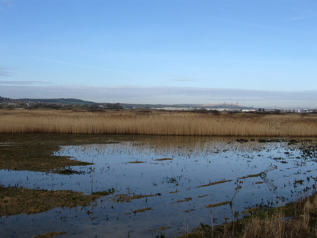
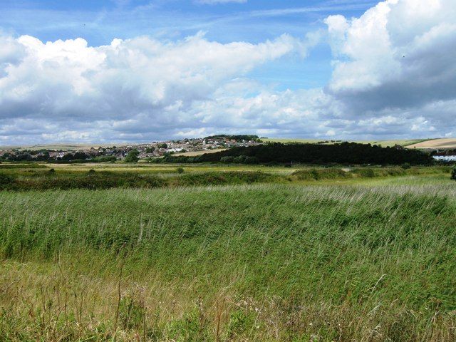
The first move to undo some of that damage came in 1993, when the old Ouse meanders, the abandoned watercourse running east of the modern river behind Tide Mills, were designated a Site of Nature Conservation Importance. A decade later, when the Newhaven business park and the realigned A26 were built, planners attached a 38.7-hectare nature reserve to the scheme. Today's Ouse Estuary Nature Reserve, jointly managed by East Sussex County Council and the Environment Agency, is the result: a working flood-storage area in winter, a grazed marsh in summer, threaded by paths, bridleways and quiet viewpoints.
The reserve is small, just over a third of a square mile, but the species list is long. Lapwing, redshank and shoveler use the open water in winter. The internationally protected great crested newt breeds in the ditches. In the surrounding pasture, brown hares are seen regularly for the first time in a generation. From April to October around ninety head of cattle graze the reserve in rotation, with some fields rested each year to encourage wildflowers and ground-nesting birds.
The car park is on Mill Drove, a 25-minute walk west of Seaford station along the seafront and the Tide Mills path.
The Old Course Still Runs
If you want to walk the river the town actually grew up around, the old course is still legible on the ground. The northern embankment of the abandoned channel is now a footpath, carrying both the Vanguard Way and the Ouse Valley Walk eastwards from Mill Drove. To the right is the modern river, a tidied, training-walled cut that runs dead straight to Newhaven harbour. To the left, low and quiet, is the line of the medieval Ouse, picking its way back towards Seaford.
Lessons from the Cuckmere
What the Ouse lost in the 16th century, the Cuckmere is now slowly recovering. The Cuckmere, the river immediately to the east of Seaford, was straightened in 1846 to dump its water into the sea as quickly as possible. Its famous serpentine loops at Cuckmere Haven were left high and dry as ornamental oxbows alongside the cut.
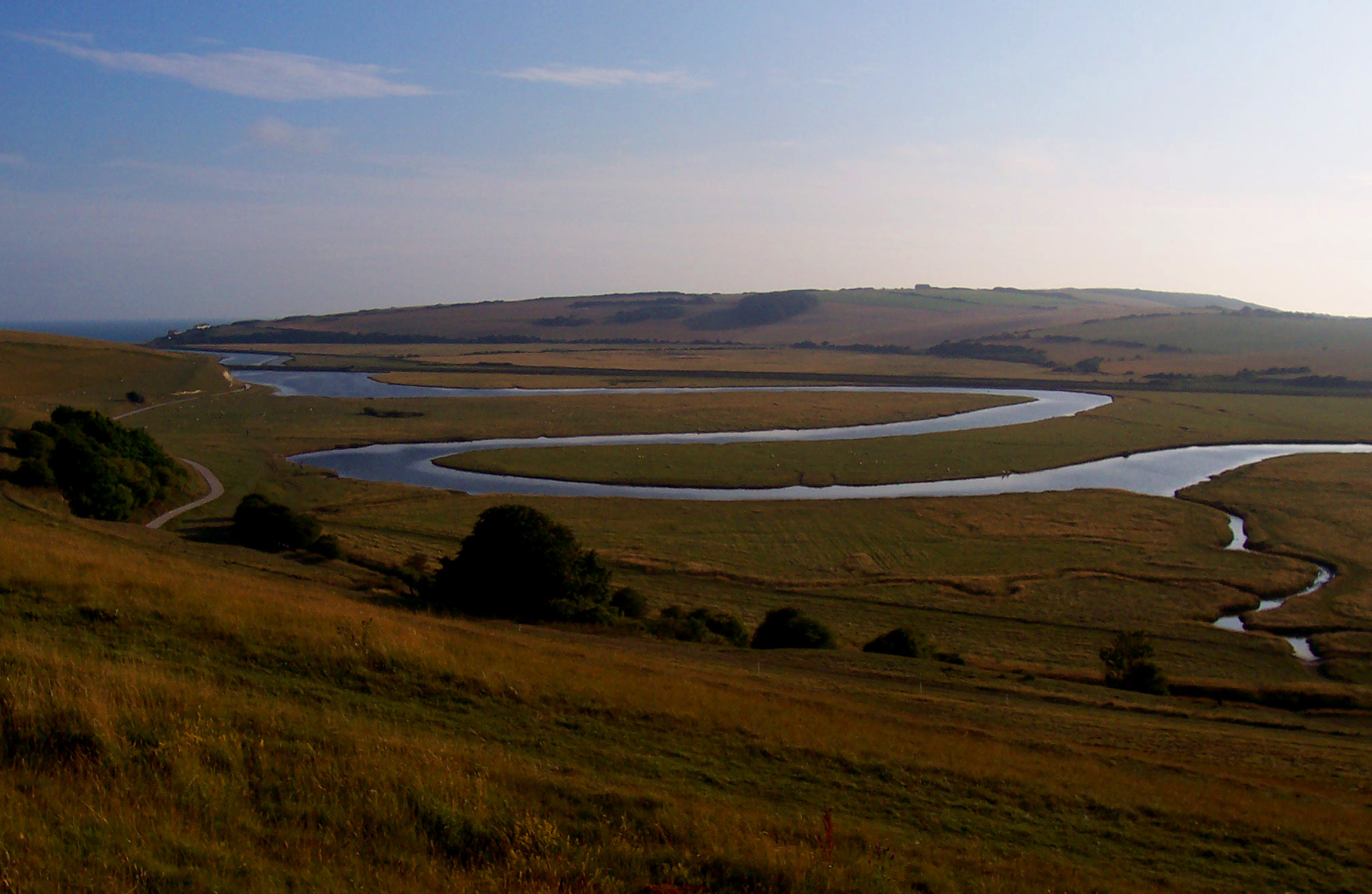
In 2001 the Cuckmere Estuary Partnership, the Environment Agency, the National Trust, Natural England, Sussex Wildlife Trust and East Sussex County Council, began planning a long, slow reversal. The aim is to reconnect the meanders to the main flow, restore intertidal mudflat and saltmarsh on the floodplain, and let the river do its own dredging by widening the mouth. Work is phased over decades, with full managed realignment targeted for around 2030.
Renaturing Seaford
The third strand is local. Renaturing Seaford is an umbrella for groups including Seaford Action for Nature, Seaford Environmental Alliance and the Seaford Community Garden, funded through the £2 million Ouse Valley Climate Action partnership. Its current campaign is the proposed Ouse Estuary Nature Reserve Extension, joining the existing reserve eastwards through the Tide Mills site to create an unbroken green corridor from the South Downs National Park to the sea.
Five hundred years after the river abandoned the town, Seaford is, gently and deliberately, inviting it back.
How to Visit
- Ouse Estuary Nature Reserve car park, Mill Drove, Newhaven (BN9 0HF). Free; open daily.
- On foot from Seaford, the safest route is the seafront promenade west to the Buckle, then the Tide Mills cycle path to Mill Drove. Allow about an hour each way.
- Best months, wintering wildfowl November to February; orchids and butterflies June to August; brown hares visible most of the year on still mornings.
Sources: Ouse Estuary Nature Reserve, East Sussex County Council (eastsussex.gov.uk); Ouse Estuary Nature Reserve Extension, Renaturing Seaford (renaturingseaford.org); Renaturing Seaford homepage (renaturingseaford.org); Seaford Community Partnership, Ouse Estuary Nature Reserve Extension (seafordpartnership.co.uk); River Cuckmere, Wikipedia (en.wikipedia.org); Cuckmere Haven, Wikipedia (en.wikipedia.org); Repairing the meanders, Seven Sisters Country Park (sevensisters.org.uk); The ebb and flow of tide mills, South Downs National Park (southdowns.gov.uk); Mouth of the Ouse, University of Sussex Coastview (sussex.ac.uk)